Pan-American Journey P15: Change of Plans Right In The Heart of Yukon And A Quick Stop in Alaska!
Azadeh
Pan-American Journey P15: Change of Plans Right In The Heart of Yukon And A Quick Stop in Alaska!
Posted on
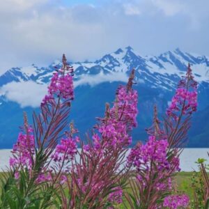
We were so excited to be in Yukon! Especially when our first stop on the remote Robert Campbell highway was a stunning crystal clear lake and we swam in it with a Moose family. It was a great experience and we knew that we will be spoiled with amazing scenery, wildlife and lots of options for wild camping.
Having enough supplies, we were hoping to take it slow and drive short distances daily and enjoy the scenery. But our first spot looked glamourous but didn’t feel like it as we started to get invaded by the army of flies and mosquitos.
If you search about Alaska and Northern Canada, you definitely hear about how bad mosquitos are in summer time but what you think you are prepared for and what we experienced were totally different.
We didn’t have any problem with Mosquitos till we reached Watson Lakes but as soon as we hit Robert Campbell highway, mosquitos started to show up. The main reason is the amount of lakes and ponds in the area. They became so many and so invasive that we couldn’t handle them anymore. We were literally experiencing hell in the heaven. We were crossing beautiful landscapes and lakes with clear water where we could even get big trouts with our hands, but we couldn’t even stay outsides for more than few seconds. I think they smell the blood and within few seconds, they attack.
So we ended up driving long distances and then stop and get to the back of the car and sit there for the rest of the day. The days started to get longer as we were driving north and we had sunset at around 10:00 pm. It was a torture to be in the nice place and not to be able to enjoy it. We were prisoned in our car.
Views on Carol Road
South Carol road sign at ross River
Our long days spent inside
Stunning views of Yukon
One of the best camps in Yukon
After doing a quick search, we realized that the deeper we get into Yukon and later on in northern Territories, the worse it gets in July. We didn’t want to live like that for the next few weeks so we had to change our plans!
Right in the middle of the highway, we decided to take a dirt road called South Carol road, which is almost half way in the Robert Campbell highway and drive south toward alaska highway and do the Alaskan leg of the trip first and leave northern Yukon and Arctic ocean for later in summer when the situation with mosquitos will get better.
It’s good to have a plan but sometimes change of plans is essential to enjoy the journey. So we headed south again toward the Alaska highway.
And along the way, we started to learn how to find the best camp spots with less mosquitos. Away from water with some open space to get the breeze and we managed to find some nice ones before getting back to the Alaska highway.
Getting to Alaska highway, didn’t mean that we solve the mosquito problem because we knew that it will be with us through out the Alaska too but at least we were hoping that it won’t be at brutal as in Yukon.
Now that we had to get back to the southern Yukon and Alaska highway, I’ve planed a detour to change our vibes and scenery a bit before driving back west toward Alaska.
Road to Skagway
Carol Road reaches Alaska Highway just before Whitehorse, the capital of Yukon. From there, instead of going west toward Alaska mainland, there is road that takes you back into British Columbia and a narrow piece of Alaska, which is squeezed between Canada and the sea and the only way to access it, is through Canada or by the sea. Our plan was to drive to this stretch of Alaska and reach a town called Skagway and from there, take a ferry to Haines which is another small town in Alaska only accessible through canada and sea and from there, drive back again into Canada at Haines Junction and carry on to Canada-Alaska main border. Just to add some fun to the trip after the change of plan and see few highlights along the way.
The first highlight of this detour was Carcross Desert in Yukon! You probably didn’t expect a desert in the Northern Canada, right?
Once the bottom of an ancient glacial lake in Carcross, Yukon, this collection of northern sand dunes is known as one of the smallest ‘deserts’ in the world. Spanning just 600 metres.
We’ve spent few hours, airing down the tires and moving around these sand dunes between pine trees and the back drop of snow covered mountains. That was truly a unique experience and a nice change of scenery.
From there we camped in a nice spot, just before the USA border and got ready for our second border crossing of the trip.
Carcross desert
The first entry into Alaska
Amazing drive to the border
The border crossing was interesting. We knew that for crossing into Alaska, we shouldn’t have any fresh produce or meat so for the last few days, we ate whatever we had in our fridge to be ready for the border crossing. We passed the Canadian side, early in the morning and had to go through a mountain pass to reach the american side. The drive was beautiful and on the american side, no one asked us anything about the fresh produce and we entered Alaska easily. This stretch of road through the mountains to reach Skagway in Alaska is simply stunning.
Skagway Alaska
Skagway is a compact city in southeast Alaska, set along the popular cruise route the Inside Passage. It’s home to gold-rush-era buildings, now preserved as part of the Klondike Gold Rush National Historical Park. The White Pass & Yukon Route Railroad runs vintage locomotives past the famously steep Chilkoot trail and offers sweeping mountain views during its climb toward Canada.
It is extremely touristy due to the fact that it is one of the main stops for Alaskan cruises. It is unexpected to see that many people in a small place especially for us that drove empty roads through Canada and the USA to reach this spot. It was a great spot to socialise a bit after being isolated for so long on the road.
It’s a seasonal town and most of the population in hospitality sector are only there during summer months that Cruise ships stop here.
An artist, singing from the window to attract tourists for their late night show in town
Famous train station
We’ve spent half a day in town and did a nice drive in the mountains which offered a great view over the town and the bay with all the cruise ships. In the afternoon, we got on the ferry which is part of the Alaska Marine Highway and connects all these towns of Alaska till the Dutch Harbour which is the last remote port on the western shores of Alaska. It’s an interesting way to travel to different parts of Alaska. We only tried a small bit for few hours and it was fun. It only took few hours for us to cross to Haines. Another town in Alaska. Haines is famous for watching Bears catching fish in the river especially before sunset. That’s were we headed right after we got off the ferry. We waited for few hours and had no luck with the Grizzlies but the views were stunning.
We haven’t seen any Grizzlies but the views were out of this world and we’ve seen lots of eagles in the area. After having no success in finding a nice camp spot around Haines, we drove toward the Canadian border and found a nice camp spot right before the border.
That was a great one day trip to Alaska and we were stoked with the views. Can not wait to reach Alaska to explore it properly. In the next post, we enter Alaska and explore the land of the mid night sun. Till then, take care and enjoy life.