Pan-American Journey P2: Mountain Passes and Eastern Sierra Nevada Wonders
Azadeh
Pan-American Journey P2: Mountain Passes and Eastern Sierra Nevada Wonders
Posted on
Last week we left you at the Golden Gate Bridge at San Francisco, the first day that we started our trip and left the comfort of our friends house in the city! The first priority for the day was filling up our water tank, both Diesel tanks and get some basic grocery shopping. These are normally pretty straight forward tasks but in a new country, it has its own challenges. Took us a while to do all three tasks and heading east!
Water tank is full now
First diesel fill up for the trip
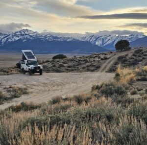
There’s a mountain range called Sierra Nevada which stretches on the Eastern side of California for 400 miles parallel to the border of California with Nevada. It’s home to famous land marks of California like Lake Tahoe, Yosemite, Sequoia and kings canyon national parks. There are few passes that takes you from the Valley of California on the west side to the eastern side of the mountain range. My logic was going East from one of the higher passes to get to lake Tahoe, then carrying on south on the eastern side and visit some interesting spots on the eastern side and then take some of the southern passes to reach Yosemite National park and later on Sequoia NP within a week or so. Sounds like a great plan on the google map, no?
To add to the fun, the plan for the first day of driving in the USA was to go through the first pass. We were a bit late to reach the pass due to all the stops that we had to take to have ourselves sorted. I’ve also pinned a place that looked nice for the first overnight camp on the road next to a lake in the middle of a forest which looked interesting. As we went higher up in the pass, we started to see the signs of snow and by the time we reached the altitude of 2300m, pretty much both side of the road were covered in snow.
It was getting dark and we finally got to the dirt road that I’ve marked for the first night camp. We got to the dirt road and after few miles, we faced a closed gate with a note on it that it hasn’t been open for the season yet due to the amount of snow on the road, perfect!
So we had no idea where to stay, it was already dark and cold and everywhere was covered in snow. We were lucky that we had a bit of network coverage and could find another dirt road on the other side of highway, to camp just off the main highway. As soon as we set up camp, it started to snow!
We won’t forget our first camp spot of our trip anytime soon. It snowed all night but the temperature wasn’t that bad. We were also so exited for the snow, since we haven’t been in this climate which we both love for such along time! The next morning we left early, it was still snowing and somehow the day before we didn’t manage to buy coffee so we headed to lake Tahoe to do some more shopping before having breakfast. We didn’t reach to the highest point of the pass the night before, as we hit the highest point in the morning, it was foggy and snowing but the good news was that the road was clear! After an hour of driving, we reached Lake Tahoe. The weather was miserable and we couldn’t even see the lake. It was still a great experience to get the vibe of the area with all the forest and wooden houses and all its ski vibes. We managed to buy coffee and have a quick breakfast. The plan for the day was reaching to the Nevadan side of lake Tahoe which according to the weather forecast, the weather was much better!
Lake Tahoe area
After driving for an hour and coming down 400m in altitude, the weather started to open up and we could look at the sierra Nevada mountains from the other side! We decided to camp early for the day and get ourselves organized before heading the road again. Found a great spot next to a river on the border between Nevada and California, called it home for the day and prepared a nice lunch to enjoy.
After a great night and recovering from the first day, we carried on south and visited lake Topaz, then we had to re enter California again. We didn’t know that for the state of California, they check to make sure that you are not taking any fresh food to the state of California. Probably it was only for trucks taking fresh food into the state but we took the inspection lane and had a friendly chat with the rangers. They were interested in our car and asked us where we are heading. After realizing that we want to take the next pass into the Yosemite, they told us that the pass is not open for the season and if we want to go to Yosemite, we have to go up to Lake Tahoe and take the same pass that we took few days ago. At that stage we decided to leave Yosemite and Sequoia NPs for September when we are returning from Alaska and stay on the eastern side of Sierra Nevada.
We took an offroad trail which was going up in the mountain to get away from the highway and reached the elevation of 2500m and again we couldn’t pass due to the snow on the road. We turned back and stopped on a nice place to have a lunch and had a visitor!
A top notch campsite for the night
Our curious visitor for lunch
We camped close to Travertine hot springs for the night and enjoyed the view of the snow covered mountains and fresh smell of wild thyme that covered everywhere in the area during the spring time. Next morning, we decided to visit the hot springs. The pools are all natural overlooking the mountains and early in the morning, there were already locals found their favorite pool and were soaking in the hot water enjoying the view. It’s interesting that clothing is optional when using natural hot water springs in the area!
After all we didn’t go for a swim since we couldn’t find a decent hole with running hot water in and out of it but it was still a great place to be. Its natural untouched setting with the view of the mountain in the background and the vastness of the space was stunning.
We knew that there will be more hot springs on our way. This area of the California is famous for its geothermal activities and there are hot springs all over the place if you know what you are looking for!
Next stop for the day was a hike called black point next to an stunning lake called Mono Lake!
Travertine Hot Springs
On the way to the trailhead of the black point with mono lake in the background
The mono lake is located on the eastern side of the highway 395, nestled in Tufa reserved area. The reserve was established to preserve the spectacular “tufa towers,” calcium-carbonate spires and knobs formed by interaction of freshwater springs and alkaline lake water. It also protects the lake surface itself as well as the wetlands and other sensitive habitat for the 1 – 2 million birds that feed and rest at Mono Lake each year. When we were there it was the time for all the Ospreys to be in the area and build up their nests on top of the tufa towers which we couldn’t see unfortunately but we managed to get great video shots from the tufa towers, coming up in our videos 😉
Mono Lake is a majestic body of water covering about 65 square miles. It is an ancient lake, over 1 million years old — one of the oldest lakes in North America. It has no outlet. The trail that we picked was a volcanic peak in the area with an stunning views over the lake and also a great canyon on top.
End of the trail!
And not to forget that we are still in California with all its dispensaries!
Stunning road back to highway 395
After a few hours hike, all we needed for the night was hot shower, cold local beer and a room with a view. We managed to find all three next to the Grant lake, just few minutes offroad on the west side of highway 395.
This area doesn’t disappoint with variety of landscapes and great campsites.
Next mission before heading east and going to the Death Valley national park was finding the right hot spring!! That was the mission for the next morning. On the other hand both of us had to work for few hours so we had to find a spot with the network coverage too. We headed to the area that I marked few hot springs that we could potentially camp next to them. The dirt roads were rocky and brutal and we managed to check 2 of them which they weren’t ideal but we finally found the one!
Perfect hot spring with the best view and network coverage. I won’t put the name, if your heading there, just let us know and we will share the spot. The interesting fact about these hot springs is their close distance to the ski fields in Mammoth area. We had interesting chats with locals that were coming for a dip early in the morning before going to ski and on their back from their ski trip.
Just the view!
And the proximity to our camping spot!
We had an amazing stay and did quite a bit of socializing with people coming for a dip in the hot water pools. After spending a freezing night and ended up with the frozen water tap, we carried on south to have a warmer spot and the running water again to have a breakfast.
Roadside breakfast in the middle of nowhere
The plan for the day was getting to Bishop, to do grocery shopping, and filling up our water tank before heading to the Death Valley. We met a nice guy with a vintage VW who stopped by and kindly invited us to his house and gave us so many useful tips for Death valley and Baja California. It’s a pleasure to meet all these beautiful souls on the way.
That’s it for this week. I’ll leave you in Bishop for now. Next week we head toward the death valley NP, till then take care.

Michael Chernishov
May 18, 2024 at 8:01pmNice!